This article is more than 1 year old
Congratulations – you're looking better than ever this morning!
America's new Earth observation sat sends home sharpest images ever
The United States' newest Earth-watcher, GOES-16, has sent back its first high-resolution images, and it's making the Earth observation community get a bit misty around the eyes.
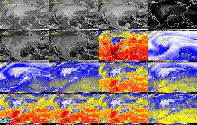
As you can see from the image above (or here for m.reg readers), the 16 spectral channels (two visible, four near-infrared, 10 infrared) on the satellite yield impressive images.
The image that heads this story is a January 15 full-disk shot of the Western Hemisphere, taken by GOES-16's Advanced Baseline Imager (built by Hughes), and you can see a much-embiggened version here.
The National Oceanographic and Atmospheric administration – unlike America's Environmental Protection Agency or Department of Agriculture, still allowed to disseminate information to the public, for now – explains here that GOES-16 has four times the resolution of its predecessors.
The image below shows images grabbed by each spectral channel.

All of GOES-16 spectral channels in action. Image: NASA/NOAA
“GOES-16 can provide a full image of Earth every 15 minutes and one of the continental U.S. every five minutes, and scans the Earth at five times the speed of NOAA’s current GOES imagers”, the release explains.
One of the geostationary satellite's key missions is to help pinpoint severe weather events in America.
In NASA's accompanying release, NOAA National Weather Service Director Louis Uccellini, Ph.D says: “High resolution imagery from GOES-16 will provide sharper and more detailed views of hazardous weather systems and reveal features that previous instruments might have missed, and the rapid-refresh of these images will allow us to monitor and predict the evolution of these systems more accurately. As a result, forecasters can issue more accurate, timely, and reliable watches and warnings, and provide better information to emergency managers and other decision makers.”
The satellite was launched on November 19 2016, and at the moment it's in a parking orbit. The NOAA will decide in May 2017 the final location for the satellite, and by November it will enter full service either as GOES-East or GOES-West.
As well as its meteorological role, the bird will provide solar and space weather data.

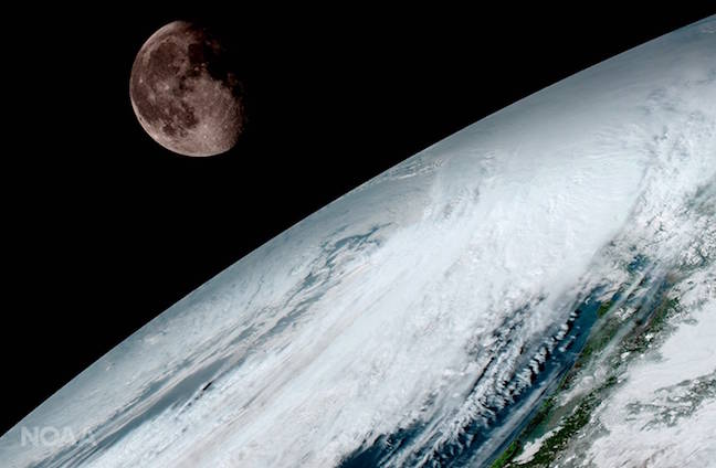
GOES-16 image of Earth and Moon. Image: NASA/NOAA
The image above, showing the moon, reveals an important detail: Earth's companion provides calibration for GOES-16. ®
